
Curious about Solorrow? Click below to download the app or scroll down to find out more about the features of Solorrow.

Solorrow finds field boundaries automatically
Solorrow detects your field boundaries automatically, you do not need to connect to another software. You can add fields by simply clicking on them on the map.
If you want to change the automaticly detected field boundaries, you have the option to draw them manually or send a shape file to Solorrow.
You cannot only add field boundaries in Germany. Solorrow offers automatic field boundaries in 22 European countries. Find out here which ones they are. In all other countries, you can add field boundaries by drawing them in manually.

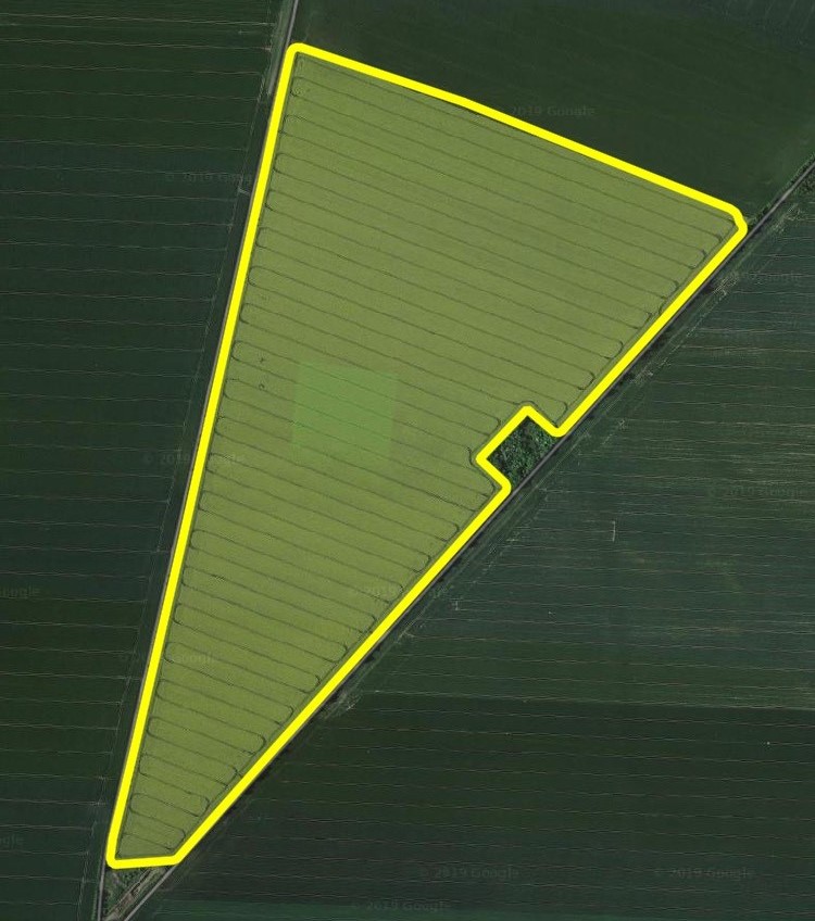
Discover your satellite based field potential map
Every farmer knows it: In one zone of the field every year a lot of plants grow much better than in another zone. There are multiple reasons for this - soil type, slope, external influences and many more.
We at Solorrow call this heterogenity of the field the distribution of growth potential. The growth potential is often not distributed evenly across the field but in many different zones. In zones with higher potential usually more biomass grows in comparison to zones with lower potential.
Based on long-term satellite image observation over the last 5 years, Solorrow discovers those zones and creates an field potential map for your field visualizing the heterogenity of the field. We use the NDVI index for this calculation. The map also shows how high the productivity differs between the zones.
You cannot only create field potential maps in Germany but worldwide!

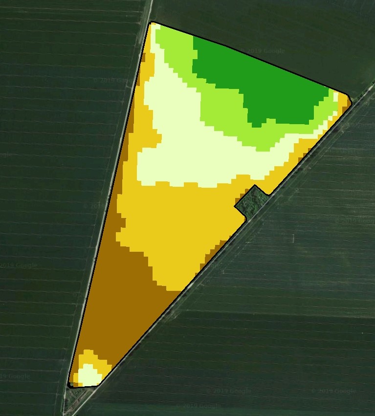
Field potential map becomes prescription map
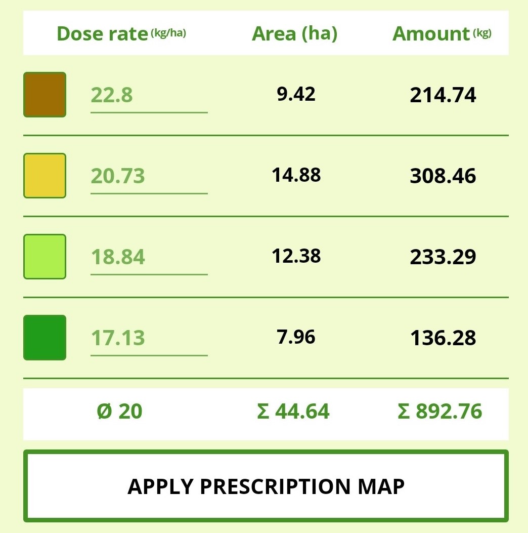
To treat your field variable, you need a prescription map - with optimal dose rates for every field zone. This way, every field zone is supported optimally and can realise its full growth potential. In Solorrow, the application map is created with just a few clicks!
You decide if you want to add a manual dose rate for every field zone or want a suggestion by Solorrow based on the zone differences.
At this stage you can even choose between different strategies and goals: Do you want to put higher dose rates for zones with higher growth potential or do you want to distribute more fertilizer to zones with previously lower biomass? Do you want to increase your yield potential with stable input or save input with stabel yield?
All of this is possible with variable application with Solorrow.

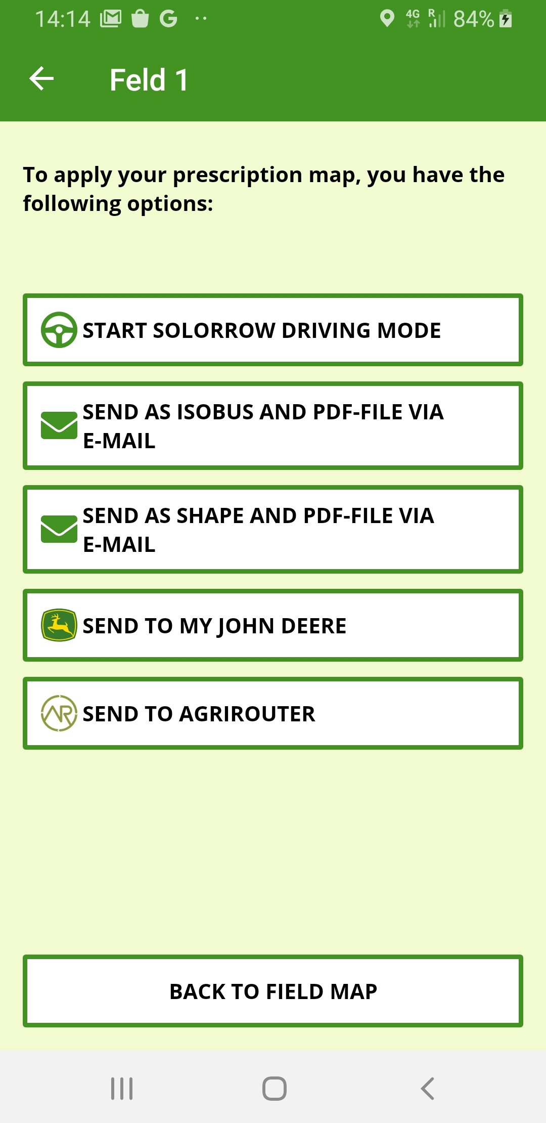
Apply via machine terminal
With Solorrow you can export your prescription map as ISO-XML- and Shape file via e-mail and import it into your machine terminal, for example with an USB-stick. This way, your machine terminal knows where on your field how much input material should be distributed without needing any manual assistance in order to treat your field variable.
Besides ISO-XML and Shape file, you also receive a PDF-file with an overview of your prescription map which you can easily open on your computer and even print if needed.
Even easier is the transfer of Solorrow prescription maps via the connections to the Agrirouter and the John Deere Operations Center. Find out more about those connections here.
ISO-XML and Shape files can be created for spreader, sprayer, row seeder and seed drill.

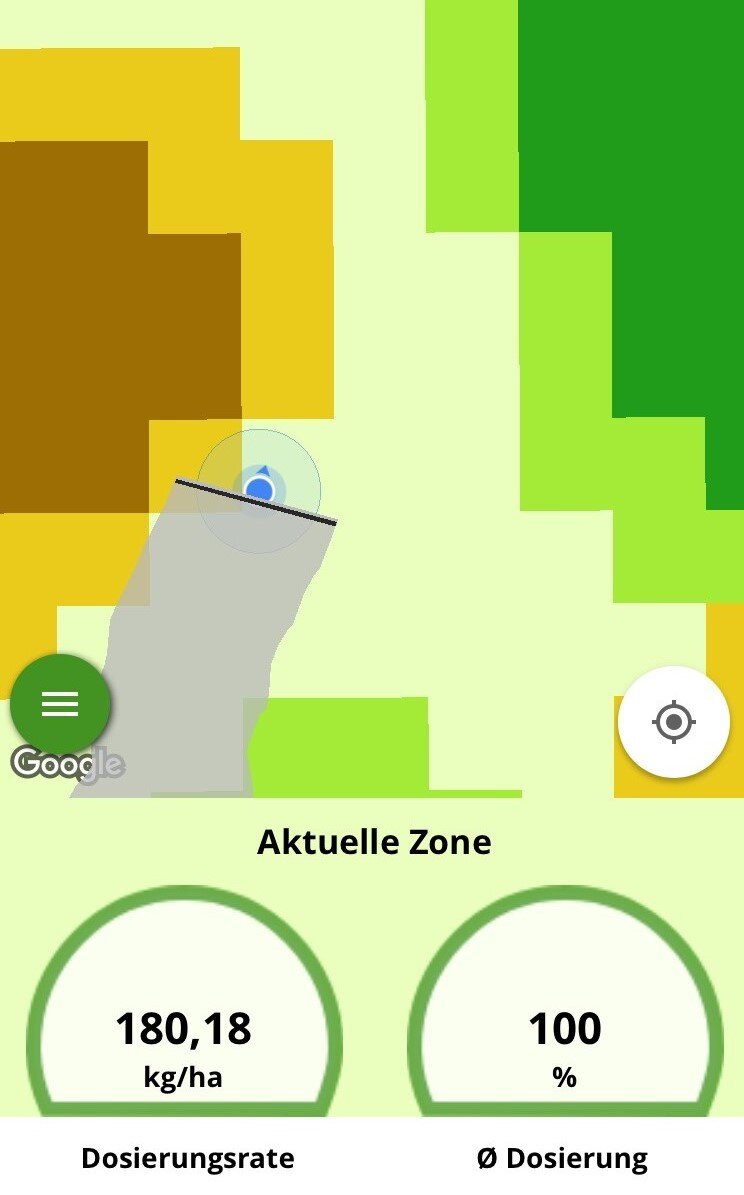
Apply via Solorrow Driving Mode
You do not own an ISO-XML- or Shape capable tractor? No problem for Solorrow!
With the mobile app you can turn your tablet computer into a navigation device: Move to your field and start the innovative Solorrow driving mode. Using GPS localization, the app knows your location on your field and shows in which field zone you are currently driving. If you switch field zones, this is automatically detected, and the optimal dose rate gets adapted.
Using the driving mode, variable fertilization with your personal prescription map becomes even easier!